2006 Excavation Results

The 2006 season ran for seven weeks, with an average of about 100 people on the mound throughout the period. The second session, in July, carried on as Hezbollah rockets battered northern Israel during the Second Lebanese War. Although Megiddo was not in the immediate area of hostilities, several team-members decided to leave the country and the Expedition assisted them to do so. The excavation continued as scheduled. The 2006 excavation was carried out in five areas. The on-site staff included Directors Israel Finkelstein and David Ussishkin of Tel Aviv University and Associate Director (USA) Eric Cline of George Washington University; coordinator of the Expedition and supervisor of Area M, Norma Franklin; supervisor of Area H, Eran Arie; supervisor of Area J, Matt Adams; supervisors of Area K, Noga Blockman and Mario Martin; supervisors of Area L, Eric Cline and Inbal Samet; registrar Margaret Cohen; archaeozoologist Aharon Sasson; computer analyst, Elena Zapatsky-Benenson; photographer, Pavel Shrago; surveyor, Alexander Pichura; administrator, Guy Avivi; and assistant area supervisors Hai Ashkenazi, Colby Bestgen, July Bidmead, James Bos, Deborah Cantrell, Jane and Robert Grutz, Philippe Guillaume, Dana Katz, Leigh Savage and Brook Shelman.
Area H
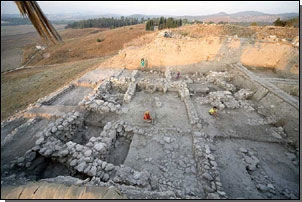
Area H was last excavated in 2000, when it reached Iron IIA layers. At the beginning of this season City Wall 325 of Levels H-4 and H-3 (the University of Chicago’s Stratum IVA) was removed and the excavation area was extended toward the slope. Area H now forms a sectional trench three squares long ª two squares wide. The excavation of the dense, domestic-in-nature Iron IIA layers was concluded. Four layers (H-5 to H-8) were unearthed, with an accumulation of debris over one meter thick. The upper Iron IIA layer – Level H-5 – ended with at least partial destruction. Toward the end of the season the excavation reached Level H-9 (the University of Chicago’s Stratum VIA of the late Iron I), which provides evidence for a thorough destruction of the city. The destruction left many finds, mainly pottery vessels, in situ, on the floors. Excavation of Level H-9 will be completed at the beginning of the 2008 season.
Area J
Excavation continued in the northern part of Area J. Excavation of the Early Bronze III layers was completed and the dig continued through Early Bronze I brick collapse to the floor of the temple-hall of Level J-4 of the Early Bronze I.
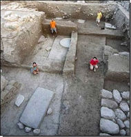
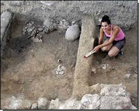
The temple-hall was found to be larger and more monumental than expected. Its front and back walls are well preserved, but the stones of one of the side-wall seem to have been robbed in antiquity. A thick accumulation of later strata hinders the search for the other side wall. The front wall of the temple is ca. four m thick, with foundations built of large field stones. The original white plaster of the walls is well-preserved in several locations. Six huge, flat, beautifully-worked basalt stones were samples were found in the temple-hall, set in three pairs: two pairs of rectangular slabs on the sides and a pair of round stones in the middle. A few smaller stones of a lesser quality were found in a row in the middle of the temple-hall. It is not clear whether the large basalt slabs served as bases for wooden pillars or as offering tables. In the latter case the small stones were the ones which had supported the pillars. Because the temple was built on the northern slope of the original hill, it must have been supported by a large terrace or support wall and a fill, of the kind unearthed by the University of Chicago in the 1930s on the eastern slope of Area BB. Animal bones were found on the floor of the temple, which was otherwise clean of finds; the temple seems to have been abandoned after being damaged in an earthquake.
The temple of Level J-4 is the most monumental Early Bronze I structure known in the Levant, if not the entire Ancient Near East. Taking into account the manpower and administrative work required for its construction, it provides the best manifestation for the first wave of urban life and, probably, city-state formation in the Levant. The temple is located on the original hill of the site, with most of the Early Bronze I site stretching further to the east, much beyond the limits of the current mound. Previous magnetometer investigation has shown that the site covered an area of ca. 50 hectares — the largest Early Bronze I settlement known in the Levant. The Megiddo countryside survey has indicated the exceptional density of Early Bronze I sites on the western margin of the Jezreel Valley. All this provides the background for understanding the monumentality of the Megiddo acropolis.
Area K
The 2004 season ended with the full exposure of Level K-6, the end phase of the Late Bronze II. In 2006 another strip of squares, on the edge of the mound, was added to the area and the western strip was abandoned. Area K now consists of 12 squares. In 2006 Levels K-7 and K-8 of the Late Bronze IIB were excavated. Area K features a uniquely-dense domestic stratigraphy of Late Bronze II layers, with significant pottery assemblages. A large number of samples were sent for radiocarbon dating.
Area L
Work in this area was commissioned by the Nature and National Parks Authority, to prepare it for reconstruction and presentation to the public.
The excavation concentrated on a strip of eight squares between Palace 6000 of Level L-3 and the baulk of Area BB of the University of Chicago’s excavations in the 1930s. Flagstone floors of Level L-1 (University of Chicago’s Stratum III) were unearthed close to the surface. Below them, the excavation uncovered the front (southern) part of Stable 3 and the front wall of Stable 4 of the Northern Stables complex (Level L-2 = Stratum IVA of the University of Chicago excavation). The remains are relatively well preserved, including the cobble and plaster floors. The attempts to locate the floor of the front courtyard of Palace 6000 (Level L-3 = Stratum VA-IVB) failed, as the area was disturbed by a large robbers’ pit in antiquity. The excavation of Area L has now been concluded.
Area M
Excavation continued here in an attempt to clarify the stratigraphy and date of the Nordburg and “The Monument” (the “Aegean Tomb” — see summary of the 2004 season) unearthed by Gottlieb Shumacher over a century ago. Middle Bronze remains were found in the eastern part of the area. One room of the Nordburg (Level M-6, Late Bronze II) was found with vessels on its floor. Brick collapse about one meter thick represents the destruction of the building. In the next phase, in the early Iron I, the area was used for open-air activity, represented by a large ashy layer found in almost every square. An elaborate building was constructed over these remains in the late Iron I (Level M-4, the University of Chicago’s Stratum VIA). At that time the area was used for cult-related activity. The building was destroyed in a major conflagration.
The dispute over the date of The Monument has not been resolved. According to one view it was originally built in Level M-6, in the Late Bronze II, and reused, with changes in the entrance complex, in Level M-4 of the late Iron I. According to another view The Monument was originally built in Level M-4, when it was inserted into the ruins of the Nordburg of Level M-6. No new data regarding the function of The Monument have come to light. The excavation of Area M has now been concluded.


